The References editor with automatic GPS adjustment can be used in rallies where the rally organization makes the road book available before the day of the rally. That is, with the route book in hand, you can make the route to draw the references and thus use the automatic adjustment by gps simply by enabling this option.
To use the automatic GPS adjustment, follow the steps below.
1. Open the Stretch Editor and select References to draw the bullet. For more details see the Reference Editor page (Basic)
2. Select the option “Automatic adjustment by GPS positioning”.
3. When you are at the exact location in the bullet that the roadbook shows, click the Update button.
4.Click on the OK button.
Repeat the same steps for all bullets that you want to use the automatic GPS adjustment.
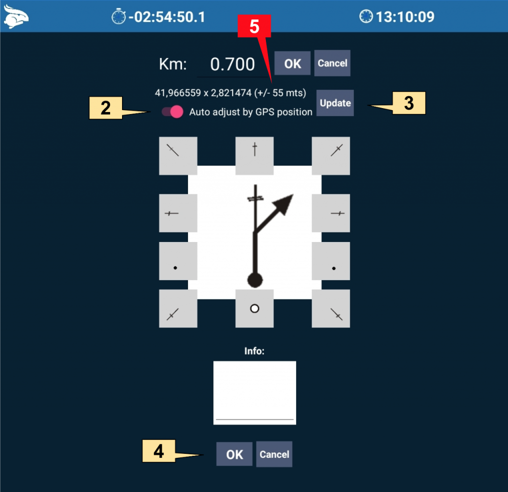
5. Important! To achieve a better precision we recommend using the Garmin Glo. See our GPS and Garmin Glo page for more details.
Now that you have the references drawn, once you go through the reference during the rally, the Rabbit Rally 2.0 will adjust the mileage up to that point and you won’t have to do anything else.